TRAIL DAY 13
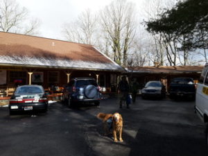
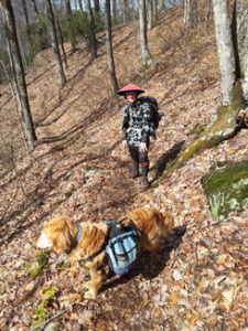
Fri, Mar 4, 2016 Resupplied from the Top of Georgia outfitter’s shop, we were back on the trail heading for North Carolina. More of the same, a brown-grey-blue-and-white day. White patches in the sky and on the ground – clouds and snow. Some moderate climbs but mostly a rolling-hills kinda day. I took my time leaving the hostel so it would not be a super long day.

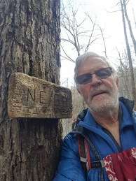
On a long steady uphill, I met “Chinaman” southbound. It was not long afterward that I came to the GA/NC border sign nailed to a tree. The border signs would have varying degrees of self-importance. They were certainly not large official highway signs impressing you with the fact that you were welcomed into another state; you’re in another jurisdiction; this is our town; come on in and stay a while. . . . Nope! Just an old wooden board on a tree telling you that you would soon have one foot in GA and the other in NC. Still brown-grey-blue-and-white. One down. Thirteen to go.
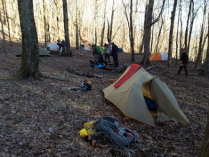
 There was a memorable campsite just inside North Carolina. The location was known as Bly Gap but I came to call it “tent-city” because of all the tents already set up to the right of the trail upon my arrival. Bly Gap was on a slope beyond which there was a steep bank up to an old, twisted tree AWOL says is often photographed. I climbed the bank to do the same encountering a tangle of thick vines on my way.
It was here that I recall the tall, dark-haired hiker who seemed all legs and arms – in a skirt! I wasn’t sure of the gender but something suggested male. This was my first of a few encounters with strange garb. Later, in summer, I would see a many wearing a kilt declining to say what was underneath. It was touted as a most comfortable way to hike. Free and easy, I guess. But this was winter. I my skirted friend wore long pants under his skirt.
I set up my tent in the best spot I could find, a clear but slanted area which, as I recall worked out just fine. If I had not learned by this time from pre-hikes, I soon would learn many ways to avoid discomfort from terrain conditions. There are many ways to make even slanting ground comfortable. I’ll mention a severe case later on but for a lateral tilt, put clothes under the downhill edge of your sleeping pad to turn it into a shallow trough. It can be really comfortable – maybe, by lending a little lateral support, even more comfortable than flat.
If the slant were vertical, head-to-foot, I would always sleep head high and put something under the pad at my knees or thighs or seat-to-feet as the circumstances warranted.

Meals have blurred into a misty history as have many of the details of each day now taken up with settled routines and walking.
Hiking the AT is a piece-a-cake. It’s one of the simplest things you can do. Set up camp, eat, go to bed, get up, eat, pack, hike-eat-hike.
There are the planning and logistics which have forced some off the trail – and they can be tricky. But all you’re really doing is connecting the dots. Just two dots! Springer – Katahdin.
Much, much easier than hiking in the Adirondacks, for example. The AT follows a mountain range – the Appalachians. If you came to a fork in the trail, it was almost always the one leading up hill that was the AT. Just follow the mountain tops northward. Although the trail diverted southbound many times, its promise was to take you north to the Maine wilderness and the mighty mountain. I often referred to the AT as the “approach trail” to Katahdin.
The Adirondacks! OMG! Take a big formless jumble of mountains and cast a huge mesh net over them to capture them for hikers and all the strands of the net are the trails you can follow. Plan that hike! It’s like being in a grocery store and trying to figure out which olive oil is yours, which cereal is best, which shampoo. When we went to Africa in 2008, shopping was so, so simple and the smiles on the faces were intoxicating with joy at being alive. Do we really need so many choices.
Well, it’s not the fault of man that there’s a spider web of trails in the Adirondacks. It’s the challenge Mother Nature gave us to make our way in her maze of mountains.

I like the simple. Point A to Point B. One simple task – that’s all. Put the next footstep north of the one you’re leaving. There is such a God-given beauty in that. How much travail of heart and mind fall off into the underbrush in the bosom of such simplicity? And, taken up in the utterly simple, it is so comforting to find that you can get along just fine without knowing the latest of anything from the culture – and the culture can get along just fine without your being steeped in it. Tie the boot and go – northward.
Northward was the only way for me. Born in Manhattan; schooled in suburban New York, Massachusetts, England, Connecticut and Pennsylvania, I had to be hiking homeward. I’m a New Englander at heart and the south is foreign territory, another civilization where I was fascinated, curious and in awe at the vastness of the mountain-scape but in exile from my homeland.
I remember turning in at tent-city while “skirt-guy” and others carried on around a campfire doing weed for sure. There was a good bit of not-so-offbeat-anymore pot-smoking on the trail and often a lot of chatter among the younger, more exuberant and energetic hikers. Top of Georgia and tent-city were the most crowded I had experienced in the early days on the AT. The first traditional start date of March 1st had past and maybe a few had gotten a jump on that but, unless they were doing better than 30-mile days, it is unlikely that the March 1st starters had caught up to us.
Regardless, it was kinda nice to be our own little community thick in the woods and the voices around the campfire were soft enough and far enough away that turning in before them worked fine.
Day #13 Top of Georgia Hostel > GA/NC border 9.0 miles
