TRAIL DAY 84
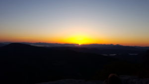 Sat, May 14, 2016 What a day this would be! It began at 6:10 a.m. with SUNRISE!
She’d gone to bed and now was back. The view couldn’t have been better for either time. Nor the weather!
Perhaps now is the time to observe that, from the perspective of the jutting rock face, the sun set far off to the left. And a mere 10 hours later, rose far off to the right, each event only slightly forward from where we viewed them, maybe 10̊ at most from a straight line east to west through where we watched. Such solar geometry clearly suggests that the view off the promontory was due north.
And, it should be noted further that the Appalachian Trail ran 4 miles out to Tinker Cliffs along the ridge line clearly visible from McAfee Knob and only a shade eastward of due north.
So! My “sense” of direction was a good 90̊ off upon arrival and for some inexplicable passage of time thereafter. I had failed to compute that the northbound Appalachian Trail was in fact heading east as we arrived at McAfee Knob. Perhaps the literally glaring cosmic evidence so mesmerized me that common sense simply evaporated in an ethereal and less earth-bound appreciation of reality. What nature delivered while I was on McAfee Knob was extraordinary and totally captivating.
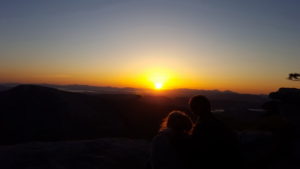
The scene was further enhanced by the presence of several hikers who rose early and climbed for their own encounter with the other worldly. A young couple sitting quietly, their faces to the rising sun, warmed my aging heart with the promise of young life joining the promise of a new day.
 Notwithstanding the spectacular events on McAfee Knob, there was need to strike a balance between the ethereal and the feet-on-the-ground “practical.” I failed to achieve that balance and paid the price – twice.
I set out with generous enthusiasm for Tinker Cliffs. The trail would soon turn from eastward to northward for the trek along the ridge we’d seen from the Knob. I had slept at the icon and was now back on the trail northbound. . .until I realized that I had left something vital at my cowboy site. My collapsible urinal. Gotta get it. I wouldn’t want anyone to find it and I needed it.
I took off my pack and made the ¼-½ mile trek back to the rock, got my bottle and returned to my pack. Just as I finished packing my blessed relief item, along came Sacket who had seen where I’d had my breakfast seated on an elevated step of rock looking out at the vast space sparkling in brilliant new-dawn sunlight.
“Did you leave your spoon behind?”
Instant (painful) awareness.
He was good to notice and to have left it for me. I guess. Maybe he wondered if it could have been someone else’s. It was mine and I knew exactly where I’d left.
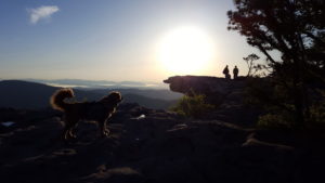 Back again through the twists and turns around high boulders and scrub brush, past the hikers with the large tents who’d advanced further in breaking camp each time I bolted by. Back to the rock. There was my spoon sitting peacefully right where I’d left it.
Then, start my day – my trek – for the 3rd time!
I returned to my pack and was on my way. I soon came upon Sacket who must have stopped to rest or tend to something. He was clearly a faster hiker than I was. We hiked under a full canopy eastward and then began a brief descent around a bend to our left for the long trek along the ridge.
En route, I took some pictures – surprise! I put my camera (phone) back in my pocket and marched on. Again, Sacket must have stopped because he came up behind me. I was frantically looking for my camera for yet another picture. It was not where I’d put it. He hadn’t seen it. I headed back to see if it had dropped out of my pocket. With great relief, I did not have to go far. Searching interior pockets led me to my phone. I had missed its home in my vest pocket and it had fallen into the torso of my jacket where is was safely suspended.
Back in business, I continued on my way, Sacket far up ahead.
I remember a mild rise that seemed to drain me. I was running on empty. I couldn’t tell if it was a poor night’s sleep which I don’t recall having. Was it the extra mile or two at the start of my day? A combination? Whatever the reason, it was not a high-octane day.
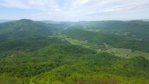
Alone, Theo and I trekked onward and eventually came to the cliffs we had seen from the Knob. The drop-off was long and, of course, dangerous. Nonetheless, I walked along the cliffs, eye on camera and ledge for a video. Happily I’m here to tell you about it. I stopped at one point where a young, dark-haired mother was sitting on the cliff as her young son was running back and forth toward the edge and away from it. He seemed to stumble once but his mom caught him. He probably would not have gone over but it was close enough that I most definitely did not forget it.
Certain distances seem to just stay locked in my brain forever. Once down from the cliffs, there was a sign noting Daleville, Virginia was 9.2 unforgettable miles away. That milage and the trek to the highway in Daleville is well embedded in my grey matter.
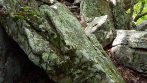 There was something about this day that was just plain difficult for me. We climbed over and between large rock formations jutting out of the ground and around, up and over great mounds of forest floor – nothing terribly steep but still fighting gravity no matter the angle. I was pushing my body forward as I forced each mile behind me. It rained a little that afternoon.
This was the first day and the first time in over 700 miles on the trail that my temper flared a bit at the trail and the day. I’ve already mentioned my flare-up with my ever-loyal Theo. But this was anger at the trail itself – and the sacrosanct and holy endeavor to which some force within was completely dedicated.
I was most often attentive to signs reading VIEW, OUTLOOK or OVERLOOK and I had seen several since Tinker Cliffs. However, exhaustion, sore feet and general weakness got the better of me. With miles to go, I saw a sign pointing off to the east:
OVERLOOK >>
I’m enough of an old timer not to abandon all vestiges of propriety in writing what burst out of my mouth at this one-too-many OVERLOOK sign but it was something like this:
F— the G– D— OVERLOOK!
I think the sudden release of pressure building under my unstinting push against the weight of sustained weariness gave me relief from blind acceptance of what the trail handed out. I could take some control – if only in words. I was not a mere victim. I had accepted everything. Gladly. The trail and whatever it had to offer was why I was out here but, on the way to Daleville, the joy of actually doing it gave way.

But never! Never did I think to quit.
Maybe the honeymoon was over ever so briefly. There’d been only one breach of my wide-open emotional, physical and spiritual acceptance of “the trail.” All was well with endless months of adventure ahead.
Meanwhile, the rest of the way to Daleville really dragged. In the last 5 miles, there are 5 references to “powerline” in AWOL. I recall the last one before the road and remember seeing the towers through the trees and hearing the buzz of super-active electrons clinging to high tension wires which I trusted would remain overhead.
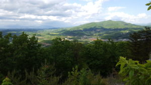
Past the powerline, over railroad tracks and Tinker Creek, I would eventually find myself amidst young, sparse growth with grass and short plants at the side of the trail which led abruptly to US 220, Roanoke Road. It was 6:00 p.m. I had made reservations at Motel 6. AWOL said: “pets OK (no fee)” and that was good enough for me. Only problem: they were 6 miles from where the trail emptied onto US 220 and they did not have a shuttle service. When I emerged, I sat on the curb and called the Motel. The lady was very nice but she was alone and there was no one who could come and get me. She said if I found another spot, there would be no charge. I hung up and considered my options. The busy road did not look like a good hitch-hiking place and besides, I was too exhausted to stand there thumb extended.
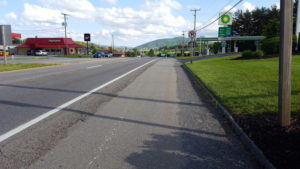 Soon Farel and Pop-tart came along from my right walking on the wide shoulder of the road. They took one look and me and said, “You look wiped.”
I assured them I was and told them my plight. They pointed to the Howard Johnson Inn just a couple hundred feet down the road on the right beyond the gas station and said, “They take dogs. Why don’t you give them a try?”
I did. They did. We stayed.
I called Motel 6 and told the clerk I found another situation and again she was very nice.
My room was on the 2nd floor at the far end of a long 2-storied building on a hilltop. The balcony walkway to my room looked over a large courtyard with an empty pool in the middle. A long set of outside steps led from the office to courtyard. Once encamped in my room, I was happy to unload, unpack and settle in.
My will and desire to be on the trail had not changed one bit but, without surrendering, I did wonder if my body was going to let me carry on. Was I going to be able physically to accomplish my goal? I had no answer – and no assumptions.
I had several things to accomplish while in Daleville: eat, of course, resupply, write an article for “In Brief” published by the Lancaster Bar Association and spray my clothes with Permethrin to ward off ticks – good for 6 washings.
On the resupply trip to Kroger in the shopping mall that I’m sure Feral and Pop-tart were headed to, I ran into Sacket. We finished shopping and joined forces for dinner. Three Li’l Pigs Barbeque was right down the way and we both ate up a storm.
After several encounters on the trail, I had come to respect Sacket. He had been to camps in the Canadian wilderness where he’d done canoe and hiking trips and he seemed well familiar with the outdoors. He knew why we saw sand on the trail – from some erosive event he described in detail. He was an experienced builder and had an extensive vocabulary matched by an absence of reluctance to use it or to display his breadth of knowledge on any subject. I felt there was a kindness and happiness to connect with others and offer any benefit he could from his personal resources. Encouraging me to bed down on McAfee Knob for example and his pleasure in Sphagnum’s name making a play on the show Magnum PI and defining her area of study: the 380 varieties of peat moss under the genus name Sphagnum.
I learned more about Sacket at the Three Li’l Pigs Barbeque, the last place I’d see him before Rangeley Maine.
Back at the Howard Johnson, I ran into Highway about 3 doors down from my end room. He had purchased a bottle of Bourbon which he was only too happy to share with me. I gratefully accepted and went to his room where he was sitting up on his bed. The TV was on. He poured me one and then another as we chatted trail talk.
He had shorts on and his right knee was extremely swollen. He was planning to go off the trail and return to his vacation home on the Eastern Shore of the Chesapeake in Maryland. He had come to the trail from there and would return from there once again when better. Otherwise he and his wife lived in the Philadelphia area. His plan was to look up Dr. Jesse Lonner whom I had recommended on the day I saw him with Diesel and Cold-Snap – the day he somehow passed me and camped down a hill off to the right side of the trail.
I was amazed how far he had gotten and sorry he had to leave the trail. I told him I was going to spray my clothes with Permethrin and he said he wanted to do the same in preparation for his return.
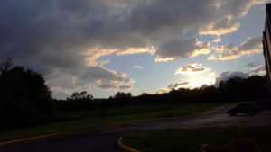
Bourbon with Highway was a nice way to end the day. We shared a certain camaraderie. I enjoyed the jocular twinkle in his eye and the wry smile at the edges of his mouth. In addition, he was closer to my age than most hikers. We enjoyed one another.
I just checked my email and see that Highway had his surgery by Dr. Lonner on September 28, 2016 after reaching Delaware Water Gap. How he did that, I have no idea. In 2017, he got to Bennington, Vermont and hopes to carry on to Katahdin in 2018 after Memorial Day.
GO HIGHWAY!
It’s hard to sit still when a fellow hiker is still out there.
I worked on my article for “In Brief” and turned in.
Day #84 McAfee Knob > Daleville 15.4 miles
