TRAIL DAY 109
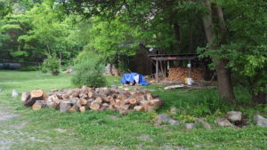 Wed, June 8, 2016 Breakfast was cook-your-own pancakes with a huge bag of mix out on the counter; the electric pan was ready to go and butter and syrup were in good supply.
I ate and made my way outside where the outfitter had said he’d meet me. He’d picked up hikers for the 8-mile ride before.
We got to the store and the kind gentleman showed me several different Merrell boots to try on and to walk around the store in. I settled on a very light-weight pair which seemed to offer the least resistance to my feet. The weight was the selling point and probably whatever pressure remained, the breathable material seemed to soften the effect.
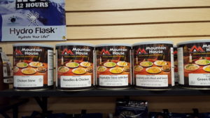
I took a picture of a row of No. 10 cans of Mountain House freeze dried food which I will buy on line in the future and pack in Ziplock freezer bags which I’m told will hold boiling water. Buying in bulk should lower the per-serving cost below single servings off-the-shelf.
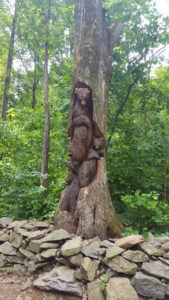
I bought an orange replacement bandana which had survival tips printed on both sides. As I’m sure pictures have shown, I string the bandana over my chest strap for ready use. Face – hands – nose – sweat – dirt – food – an all purpose item. Pot and spoon – they get the chamois. I got some supplies but I forgot Deet when he rang me up. He threw in a small bottle on him and then drove me back to the Bear’s Den. This was the first time I saw the appropriate carving at the gate.
We did not get underway until 11:00 a.m.
As I review pictures going forward, I must say, “Oh, the value of a decimal point!” For lack of one, I did all my musing about RT 7 in New England when, in fact, the sign was referring to VA 7 which was very close to 6.25 miles from that sign.
Now, I have to admit that we do get lost and can misperceive things on the trail. Had I checked in AWOL, I would have seen VA 7 up ahead. Had the decimal point been clear, no problem.
Oh, well, as always on the trail, eat your mistake and carry on.
I did learn something, though. I now know where the AT crosses Route 7 in Massachusetts. Perhaps you’ll laugh with me when we get there – on August 3rd.
VA 7 is a wide ribbon of road visible from a rock overlook within a quarter mile of the Bear’s Den.
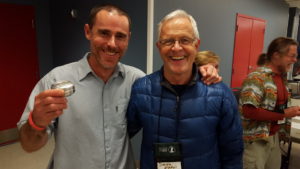
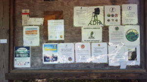
I crossed VA 7 to a bulletin board loaded with ALDA information. ALDA stands for the Appalachian Long Distance Hikers Association. Every year they have a GATHERING of LD hikers and welcome the current class of thru-hikers. They have workshops, demos, gear supplies and a ritual of seeing who has hiked the farthest among the attendees. I’m not sure what number they start with but let’s say it’s 2000 miles.
Everyone who’s hiked 2000 miles stand up.
People sit down as the question is repeated with 5,000, 10,0000, 20,000, 50,000, over 50,000 until maybe only one person is left standing.
I went to a GATHERING in Gettysburg, Pennsylvania in 2009 and one in Shippensburg, Pennsylvania in 2015. I had gotten hooked on making alcohol stoves from coke cans and had over 500 of them. I was going to sell them at the GATHERING but ended up giving them away. The speaker in 2015 was “Swamy,” who has a website called thehikinglife.com. Swamy, also known as “Cam,” must have hiked over 70,000 miles by now on multiple continents. His website is full of his interesting adventures and hiker information. Swamy took two of my stoves which, if he’s used them, would have been to many exotic places for sure.
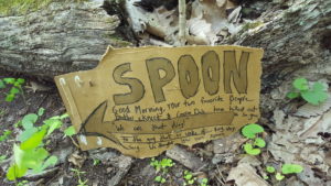
Every so often you’d find an interesting hand-written note on the trail that would tell you about bees, snakes, Trail Magic, the death of a beloved AT friend or something lost or found. “Spoon” got an interesting message from friends.
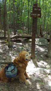
At 1:30 p.m., Theo and I would cross into West Virginia. A close look at a trail map makes it clear that the trail does many border crossings here as it did at the North Carolina-Tennessee border. The trail would be littered with signs if every point one passed from Virginia to West Virginia and back again were noted. That was avoided farther south and here.
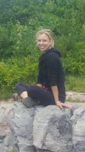
It was a brilliant day and it delivered up brilliant and expansive views on occasion. At one such view a pretty blond day hiker was enjoying the sights. I was glad to see her and the expansive terrain. I took a couple of pictures of her and she took some of me and Theo and then was on her way. There was another fellow there I had seen briefly before enjoying snacks.
I took several videos of the tall green trees swaying in strong winds. It was other-worldly and exhilarating as if we were being visited by a supernatural presence. Little wonder primitive man worshiped these forces of nature before he took up science.
I have mentioned before the lore of the trail. The mystique that surrounds phenomena one will encounter going forward. Suspense and perhaps a little rumbling of trepidation linger until your boots are there.
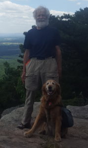
Such a place was The Roller Coaster. Its name says it all. Up and down, up and down. . . . Now why would that get any special attention on the Appalachian Trail? Isn’t that what it’s all about – why we’re out here? Hadn’t we been doing up and down for over 1000 miles already? Who cares? Carry on.
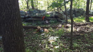
What’s in a name? Aaaay, the special character of a name cannot be eradicated except by encounter – embrace it! Have you ever found yourself shy, intimidated or full of fanciful thoughts about someone – until you engage them in conversation? And then, peace, comfort, interest, even joy! Engage! Hike on!
One had to engage with these specially named places to make them your friend. Yea, a lot of ups and downs in the Roller Coaster but so what? This was the way to Harpers Ferry, West Virginia and that’s where we were bound.
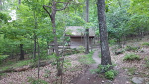
The start of the Roller Coaster was not so bad. Long dry dirt sections through sparse woods, rocky in parts. Few places to visit Mother Nature if the need arose. I took cover behind a rocky mound hoping no one would be coming along. Theo stood watch – well lay watch. By 7:00 p.m. we were at the David Lesser Memorial Shelter, a nice, clean structure with a big porch and a separate food pavilion with a swinging bench. A couple had already claimed their spots at the shelter and I set up mine.
Water was from a spring .2 miles downhill from the shelter. I recall seeing campsites as I made my way down. There were clearings and picnic tables. We filled and returned and I set up one of my trekking poles with the end sticking out from the porch so I could hang my plastic apples bag filled with water for use in the morning. It would slowly drip away from the floor with enough remaining come sunrise.
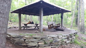
It was time for supper in the pavilion. A couple of people shared the table with me, one a tall young lady by the trail name “Slimrims.” Perhaps she was a biker. Whatever, she was very interesting. She had studied the nomadic culture of truck drivers and liked to write, taking notes in her AWOL just as I did. Her dreams for summer jobs in college were much like mine. She wrote her email in my AWOL and I have been in touch – she is presently at Denali in Alaska and has sent me a few pictures. I had found a kindred spirit.
When I turned in, Theo stayed out on the porch.
Day #109 Bears Den Hostel > David Lesser Memorial Shelter 9.9 miles
