TRAIL DAY 1 (CONT)
 Mounting the falls was the first of what would be many successes in the months to come. All obstacles not yet encountered loom in the imagination and take on a life of their own. The reports of their character might be overstated by some fearful soul marching onward in mild dread or by a southbounder who wants to impress the listener with what he has already endured. And the words of description sink into the mind conjuring up images without limits – the canvass of the imagination has no boundaries, no borders. When the obstacle is encountered, however, it may even be very difficult but each step focuses the mind on the immediate task at hand and the obstacle becomes real but not beyond managing, perhaps with risk and even misstep and injury but, as pilots like to say, “a good landing is one you walk away from.” If you’re still walking after encountering an obstacle, all is well.
And a further point, Mark Twain is reputed to have said, “I have been through some terrible things in my life, some which actually happened.” So it was with rumors of obstacles. Most were not an issue.
There was an open area of Mother Earth at the top of the grated steps. Theo and I stopped to take her in after our climb and were soon on our way, Theo in the lead and waiting on me.
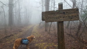
In time we were at the turnoff for Len Foote Hike Inn (1.0E). AWOL makes it clear that his Guide will use west and east for locations off the trail, which for the northbounder means left and right respectively. Only 3.4 miles to go to Springer Mountain and only 1.9 to the Black Gap Shelter.
It surprises me but I did not take a picture of that first shelter, 7.3 miles in. I can have a knack for numbers and this distance is just there without AWOL, in some repository of the inner me. AWOL confirms the number and the fact that it was off to the left of the trail (0.1W).
The memories that flood the mind are legion. How little of what we do and see all the days of our lives can be captured! A near-death survivor once emphasized what is stored in our minds (and how easily we talk of this organ) saying, “My whole life – and I mean my. . .whole. . .life – passed before my eyes.” When I think of this, I imagine that every blade of grass I saw on the trail, every flower, tree, cloud or raindrop is stored in there somewhere. Surely not all needs to be accessed but, molded by our creativity and what percolates to the surface, we can give shape to only the merest fraction of input we receive in this life – on this planet – under the infinite universe in which we travel.
I remember the tall, thin, young male hiker named Alex with whom I shared that first shelter that first night on the trail and I remember, with the help of a very brief note in my AWOL Guide where I jotted down tidbits of the experiences of the day, he sent a GPS signal via a SPOT locator so his mother would know where he was. And so a young hiker would do. At 74, I had no family except my wife and the ones I fathered to keep posted – and so I did with my own SPOT. This device connected via satellite to the web, placed a pin at your exact coordinates on a Google map. The owner could send a link to this map to 10 pre-selected email recipients with a standard. Mine was something like “Theo and I are doing fine.”
I have no idea what I cooked for supper that night but I doubt I hung my food away from bears believing none would be around in winter. Speaking of which, people think, “Oh, yea, you’re smart to start in the south in winter where it’s warmer.” You can put that thought out of your mind. The peaks in the south are numerous and high. In fact the tallest peak on the trail is in Tennessee: Clingmans Dome at 6644′. Mount Washington, in New Hampshire is the 2nd tallest at 6289′. Georgia gets its worst snows in the 3rd week of March. A man who had summited Everest hiked in the Smokys which hug the border between North Carolina and Tennessee and died of hypothermia. I was encouraged to bring a sleeping bag rated for 0̊ temperatures but, with all the layers of clothes I brought, I felt O.K. and, but for a few shivering nights, I was.
Day #1 Amicalola > Black Gap Shelter 7.3 miles
